WASHFOLD HOME PAGE ——WASHFOLD AREA MAPS PAGE —— WASHFOLD SURVEY PAGE
These are the washfolds above Hall Dunnerdale
WF14 between Lad Howe and White How
WF15 Sling Beck SW of High Stonythwaite
WF16 Sling Beck, Crowberry Hill
WF14 in Area 5, Above Lad Howe
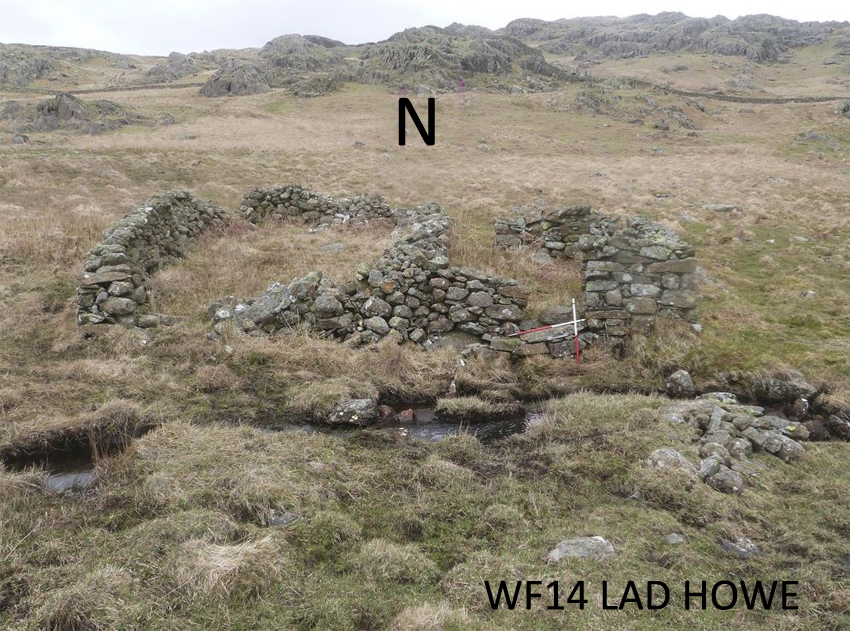
Washfold above Lad Howe on a feeder beck to Sling beck. The fold is located at SD 20780 96640 at an altitude of 325m above sea level. It is recorded in the National Park Heritage Environment Record as 7683 and is recorded as mcwb08 in the Duddon Valley Local History Group survey, Ring Cairns to Reservoirs (R2R) survey in 2009. It is in Cumberland, previously Copeland. Its condition is medium and the certainty that it is a washfold is good.
Constructed from field stones.
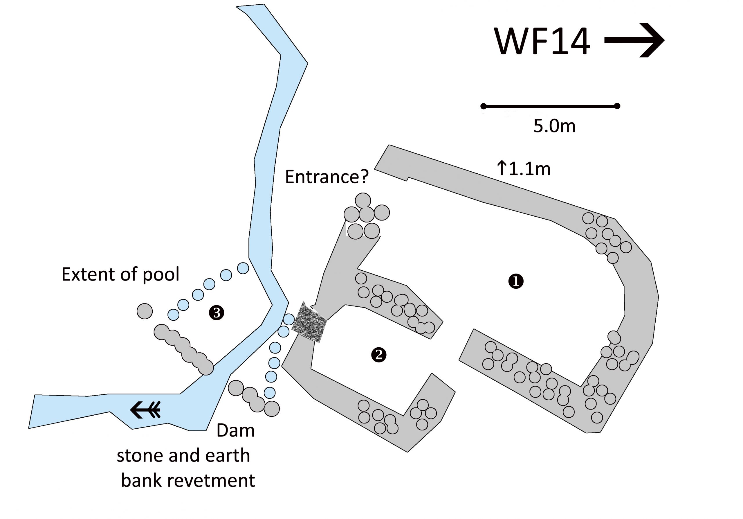
Click on plan to enlarge then use back arrow to return to this page
Dimensions: chamber 1- 9.4×3.6m; chamber 2- 3.4×2.5m; extent of pool 3- 4.0×3.0m
Wall height: generally 1.1m
Description:
A two chamber washfold situated in a flat area in the close below the fell wall surrounded by minor fells to the North and West in the near distance. Remains of dam to form pool evident. Walls collapsed in parts but other lengths are complete with capping stones. No hog hole but possible entrance to Chamber 1 then sheep could have been dispersed via the north opening of Chamber 2.
Recorded by: Rob Mckeever, Dave Hughes, Barbara Green and John Jordan on 14th April, 2022
WF15 in Area 5, South West of High Stonythwaite
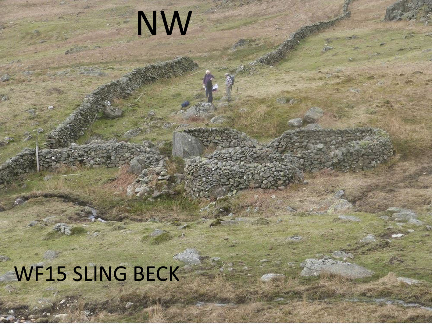
Washfold on Sling Beck. The fold is located at SD 21082 96582 at an altitude of 335m above sea level. It is recorded in the National Park Heritage Environment Record as 39579 and is recorded as mcwb07 in the Duddon Valley Local History Group survey, Ring Cairns to Reservoirs (R2R) survey in 2009. It is in Cumberland, previously Copeland. Its condition is good and the certainty that it is a washfold is good.
Constructed from field stones. There are small outcrops terminating the walls.
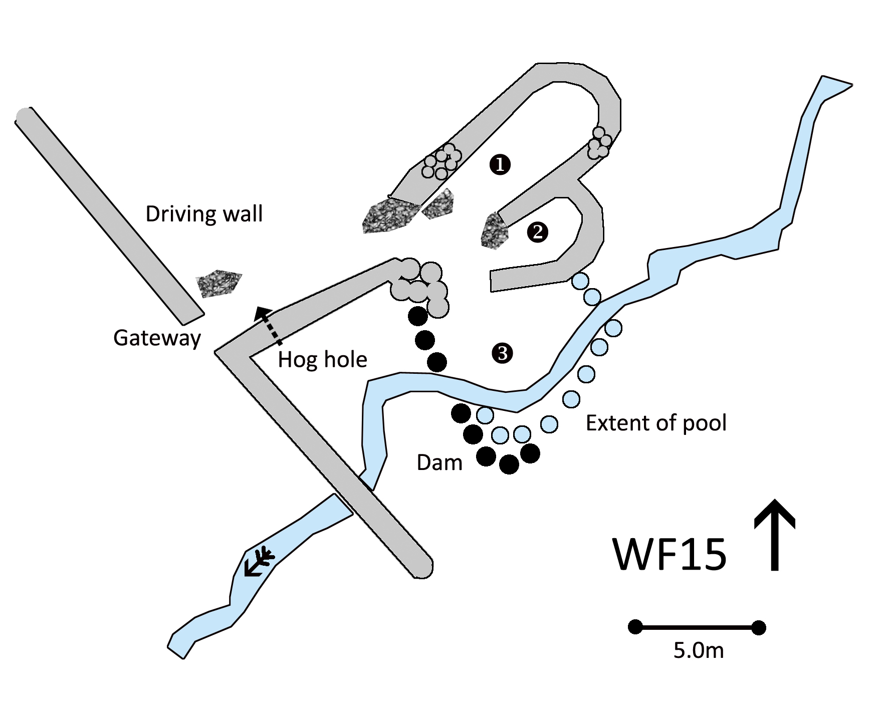
Click on plan to enlarge then use back arrow to return to this page
Dimensions: chamber 1- 8.6×3.2m; chamber 2- 4.7×2.0m; extent of pool 3- 6.0×6.0m
Wall heights: not recorded
Description:
A two chamber construction. Situated in the close below the fell wall amongst rock outcrops. The construction utilises two large fixed stones. The dam and pool/flood area are still evident.
Recorded by: Rob Mckeever, Dave Hughes, Barbara Green and John Jordan on 14th, 2022
WF16 in Area 5, Sling Beck, Crowberry Hill
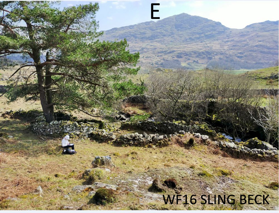
Washfold at Crowberry Hill on Sling Beck. The fold is located at SD 20852 96006 at an altitude of 234m above sea level. It is recorded in the National Park Heritage Environment Record as 39577 and is recorded as mcwb19 in the Duddon Valley Local History Group survey, Ring Cairns to Reservoirs (R2R) survey in 2009. It is in Cumberland, previously Copeland. Its condition is medium and the certainty that it is a washfold is good.
Constructed from stones, large boulders and existing outcrops.
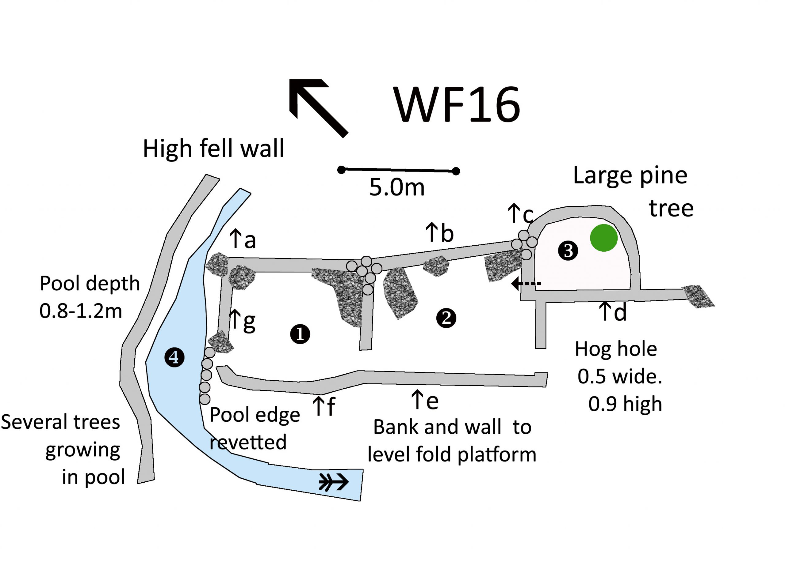
Click on plan to enlarge then use back arrow to return to this page
Dimensions: chamber 1- 5.8×4.5m; chamber 2- 6.0×5.0m; chamber 3- 4.3×3.5m; pool 4- 6.0×3.5m
Wall heights: a 1.2m; b 1.4m; c 1.2; d 1.1m; e 1.8m; f 2.0m; g 2.0m
Description:
A gathering wall leads through three chambers to an exit into a deep pool in the beck. A third chamber is isolated with a blocked hog hole. With no access for sheep, a large pine tree is growing there. The chambers are on largely level ground with the south western walls built up on outcrop and large boulders. The pool is nearly one metre deep with no signs of damming. Trees are growing in the pool so the water level must have been lower in the past
Recorded by: Stephe Cove and Dave Hughes on 26th March, 2022
WASHFOLD HOME PAGE ——WASHFOLD AREA MAPS PAGE —— WASHFOLD SURVEY PAGE