The Ring Cairns to Reservoirs (R2R) project, which finished in 2009, discovered a huge number of previously unrecorded archaeological sites in the Duddon Valley. Many of these were presumed to be the remains of agricultural buildings, but were often high on the fellside in locations which are now unsuitable for agriculture. There was much speculation about the possible age and purpose of these structures, and it seemed probable that some were of medieval origin. In particular, the footprint of some structures indicated that they might have been longhouses.
Longhouses were rectangular, single-storey medieval farmhouses which usually sheltered both humans and livestock under one roof, and were distinct from shielings which were only occupied seasonally by herders as part of transhumance practices. The simplest longhouse layout consisted of two approximately square rooms, one for the farming family and one for the sheep and cattle in wintertime, often separated by a cross-passage leading from an entrance in the middle of the long side.
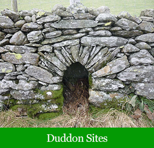
The drystone walls could be single- or double skinned, but were rarely more than a metre in height. They might have been built up a bit with turf, on top of which rested the A-frame roof timbers which in turn supported a turf or thatch roof covering. The longhouse design appeared in Cumbria towards the end of the first millennium AD, and it is thought to have been introduced by settlers of Norse descent who migrated primarily from Ireland and the Isle of Man.
The Norse influence on Cumbria was strong, as evidenced by the many place-names, burials and treasure hoards of Scandinavian origin. However, although a number of Cumbrian longhouses have been excavated, none have yet provided unequivocal evidence of occupation by Norse people. Some of us in the Duddon Valley Local History Group (DVLHG) were involved over 20 years ago in an excavation of a probable Norse longhouse with rounded ends at Stephenson Ground in the Lickle Valley, but no artefacts of definitely Norse origin were found. It was therefore hoped that some of the structures recorded by R2R might eventually be excavated to find out whether their original occupants were Scandinavian farmers living in early-medieval times (800-1000 AD), or whether the structures seen today had been constructed in the mid- or late-medieval period to a design handed down from the period of Scandinavian settlement. But first we had to document the surface appearance of the structures we had located in much more detail…
The original longhouse project plan records that we set up the Duddon and Lickle Valley Longhouse Project in February 2011 with the explicit purpose of investigating possible longhouse structures ‘ in such a way that we record the relative positions of each site and other information that will, together with archival research, enable an in-depth comparison of them to be made. The purpose of this work will be to understand more fully the number and type of such settlements, and enable the selection of sites for future excavation’.
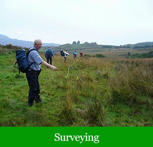
The longhouse project, which concluded in spring 2013, directly involved over 30 volunteers from DVLHG, and was guided by professional archaeologists John Hodgson of Lake District national Park Authority and Jamie Lund of the National Trust, with further assistance from many others. Its primary objectives were to conduct more detailed Level One surveys of 37 structures than had been possible during R2R, and then to carry out Level Two measured surveys of those considered most likely to conform to the longhouse type. In both cases, attention was given not only to the putative longhouse itself, but also to its surrounding landscape in order to bring to light any associated agricultural features. The 16 structures ultimately chosen for Level Two survey were picked after careful scrutiny of the Level One data and close consultation with the LDNPA and NT archaeologists.
The Results
The detailed results (Matthiessen et al., 2013) can be found in the project report where they have been discussed in the context of existing information on other Cumbrian longhouses. A combination of the archaeological and historical data has led to a tentative conclusion that most or all of the 16 surveyed structures date from the mid to late medieval period, and all were probably abandoned by the mid-19th century.
Most are located on what is now marginal land on the valley sides, at altitudes of 200-300 metres. Three well-preserved structures appear to conform to the two-cell longhouse type, while two single-celled structures in good condition may have been shielings. Several of the structures were grouped into small settlements. Others of the 16 structures may also have been longhouses, but their current poor condition makes this judgement more problematic in the absence of excavation.
The Conclusion
Most of the structures are surrounded by landscapes containing traces of early agricultural activities, particularly low enclosure walls and clearance cairns, some of which show evidence of a direct association with the surveyed buildings.
The available information suggests that the buildings’ occupants were predominantly pastoralists.
The longhouse project report concludes with several recommendations, including the need to put in place measures for the on-going care of the surveyed buildings. Proposals are also made for a new project to excavate one or more longhouses in order to establish building dates and add to knowledge about the lives led by medieval Cumbrian farmers.
Read the full report…
Our Projects Gallery
Click on the images below to view more images in the gallery…


