WASHFOLD HOME PAGE ——WASHFOLD AREA MAPS PAGE —— WASHFOLD SURVEY PAGE
These are the Holehouse and Corney Fell washfolds
WF39 Holehouse Gill
WF40 Storthes Gill
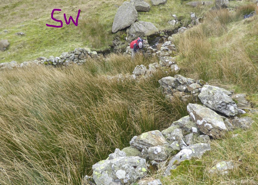
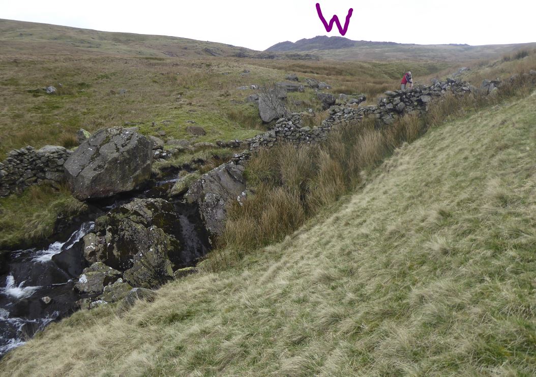
WF41 Sele Bottom, Ulpha
WF42 River Duddon, South of Sella
WF43 Logan Beck
WF44 Thwaites Fell
WF45 Bigertmire
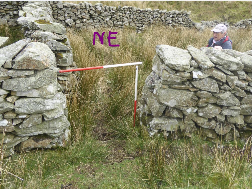
WF39 in Area 10, Holehouse Gill
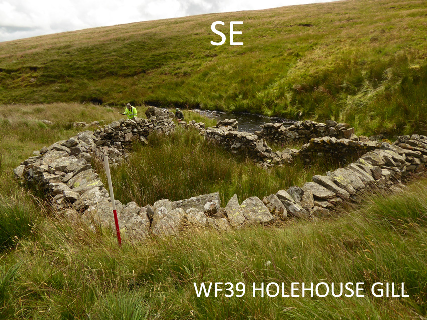
Washfold above Holehouse on Holehouse Gill. The fold is located at SD 17107 93838 at an altitude of 300m above sea level. It is recorded in the National Park Heritage Environment Record as 61104 and is recorded as mcuf19 in the Duddon Valley Local History Group survey, Ring Cairns to Reservoirs (R2R) survey in 2009. It is in Cumberland, Copeland. Its condition is good and the certainty that it is a washfold is good.
Constructed from large boulders and field stone.
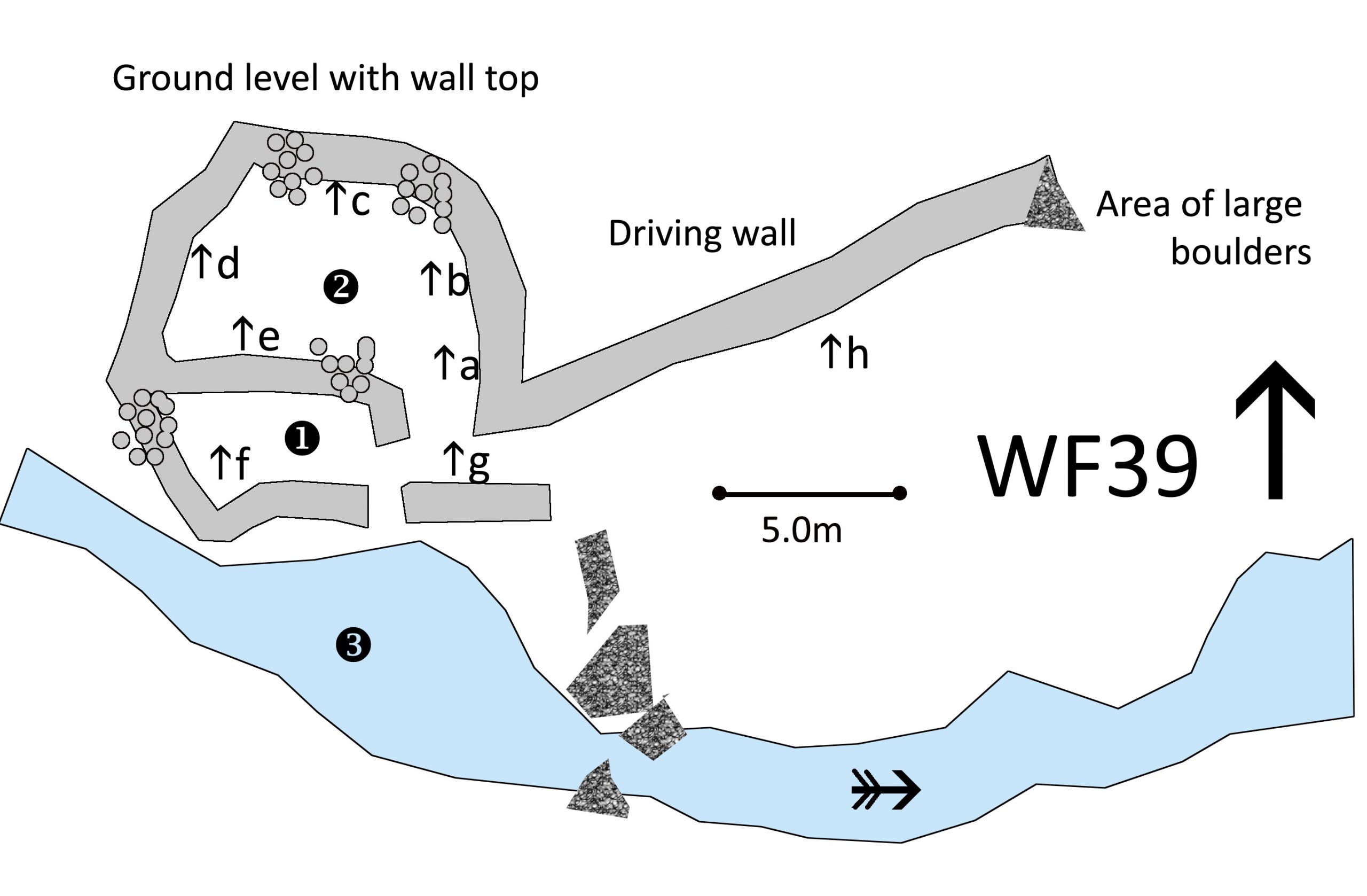
Click on plan to enlarge then use back arrow to return to this page
Dimensions: chamber 1- 5.0×2.7m; chamber 2- 8.0×5.0m; pool 3- 12.0x6m; driving wall 12.9m
Wall heights: a 1.3m; b 1.4m; c 1.5m; d 1.2m; e 1.0m; f 1.0m; g 1.1m; h 0.5m
Description:
Driving wall leading through a complex entrance into two chambers on a platform cut into the bank so the outside ground is level with the wall top for some of the landward perimeter. This is one of the largest pools seen and is natural with no signs that damming has been needed. There was a depth of nearly one meter at the bank by the exit. The driving wall is a roughly built tumble of large stones.
Recorded by: Stephe Cove, Bob Mayow and Eve Bachmann-Johnson on 2nd July, 2022
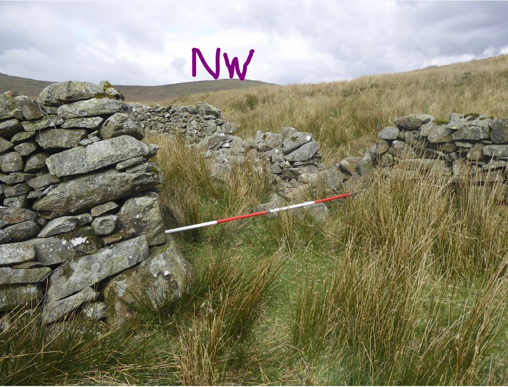
WF40 in Area 10, Storthes Gill
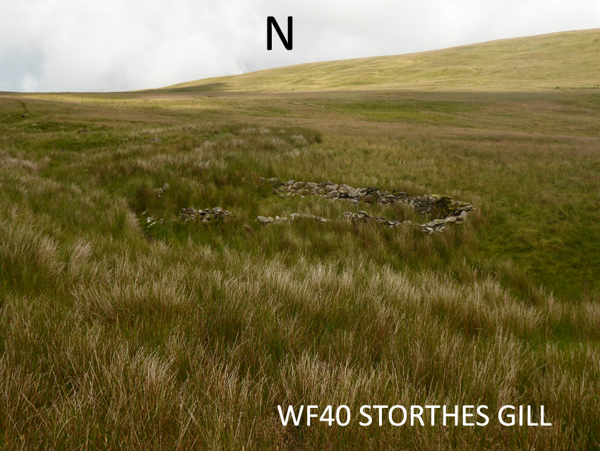
Washfold at Storthes above Holehouse on Storthes Gill. The fold is located at SD 16743 94318 at an altitude of 331m above sea level. It is recorded in the National Park Heritage Environment Record as 64645 and is recorded as mcuf16 in the Duddon Valley Local History Group survey, Ring Cairns to Reservoirs (R2R) survey in 2009. It is in Cumberland, previously Copeland. Its condition is medium and the certainty that it is a washfold is good.
Constructed from field stones though there is no sign of any source of building material in a large local area.
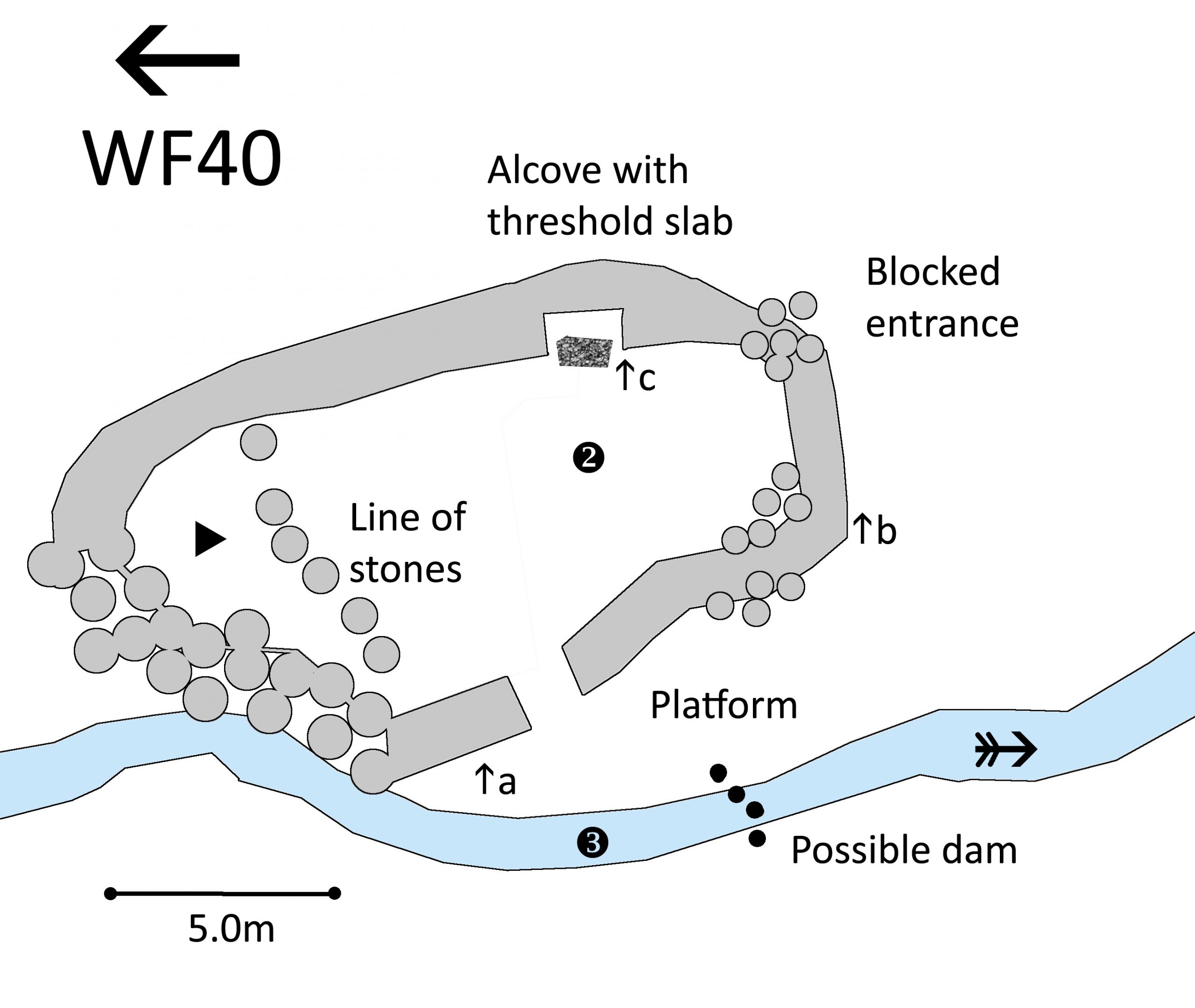
Click on plan to enlarge then use back arrow to return to this page
Dimensions: chamber 1- 3.9×2.7m; chamber 2- 10.8×6.2m; pool 3- 5.0×1.0m
Wall heights: a 0.7m; b 0.7m; c 1.0m
Description:
A two chambered fold located in a remote area high up the side of the fell with no sign of any source for stones in view. Tumbled stones have blocked the entrance from the fell. The whole of the inside is choked with rush. The divide between the chambers is just a line of stones with no tumble to suggest it was ever more than this. The beck is in a narrow channel but there is a flat platform above the signs of a dam suggestin how big the pool could have been. There is clear alcove built into the wall with a flat stone base. In a woodman’s hut, you would have thought it a fireplace.
Recorded by: Stephe Cove, Bob Mayow and Eve Bechmann-Johnson on 2nd July, 2022
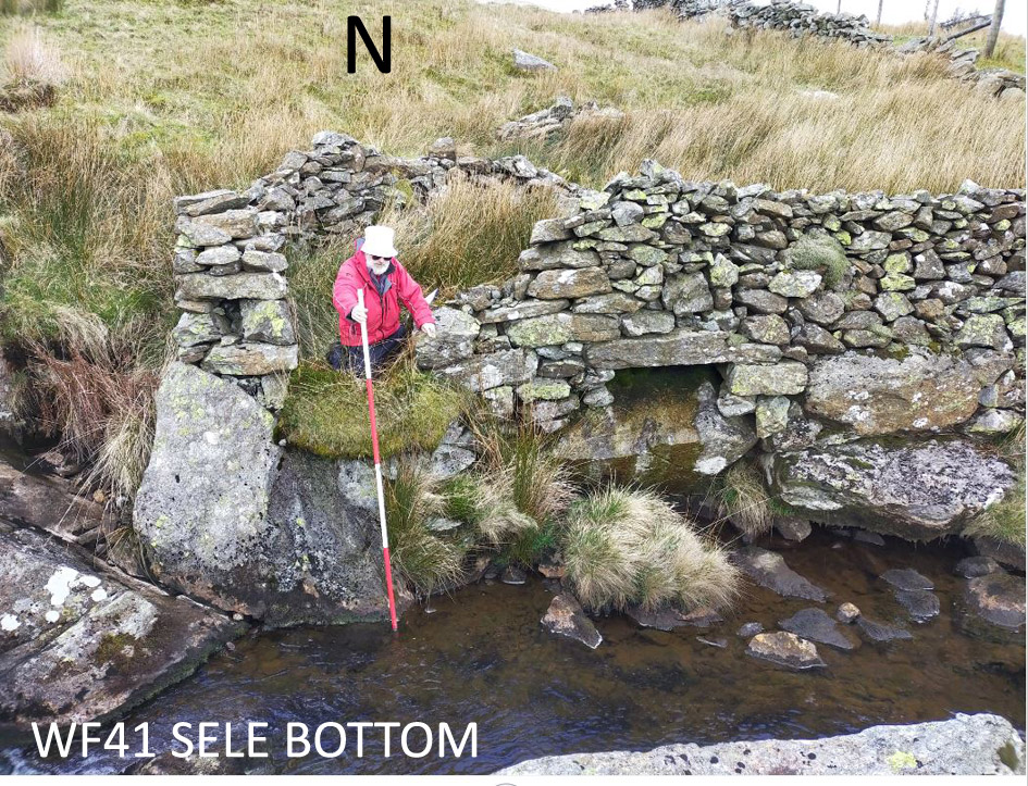
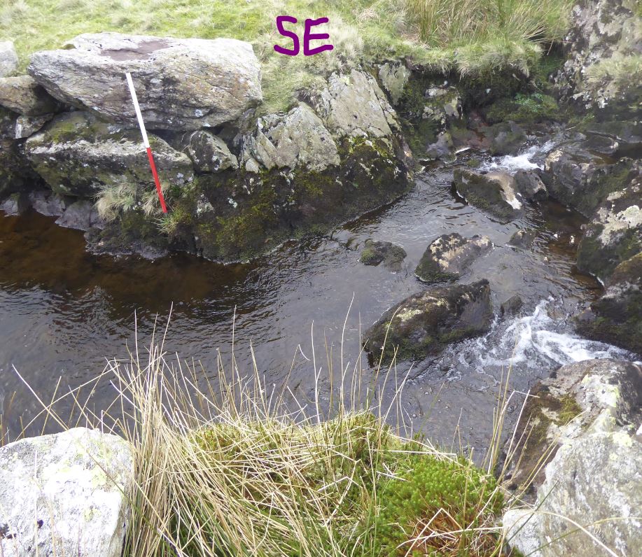
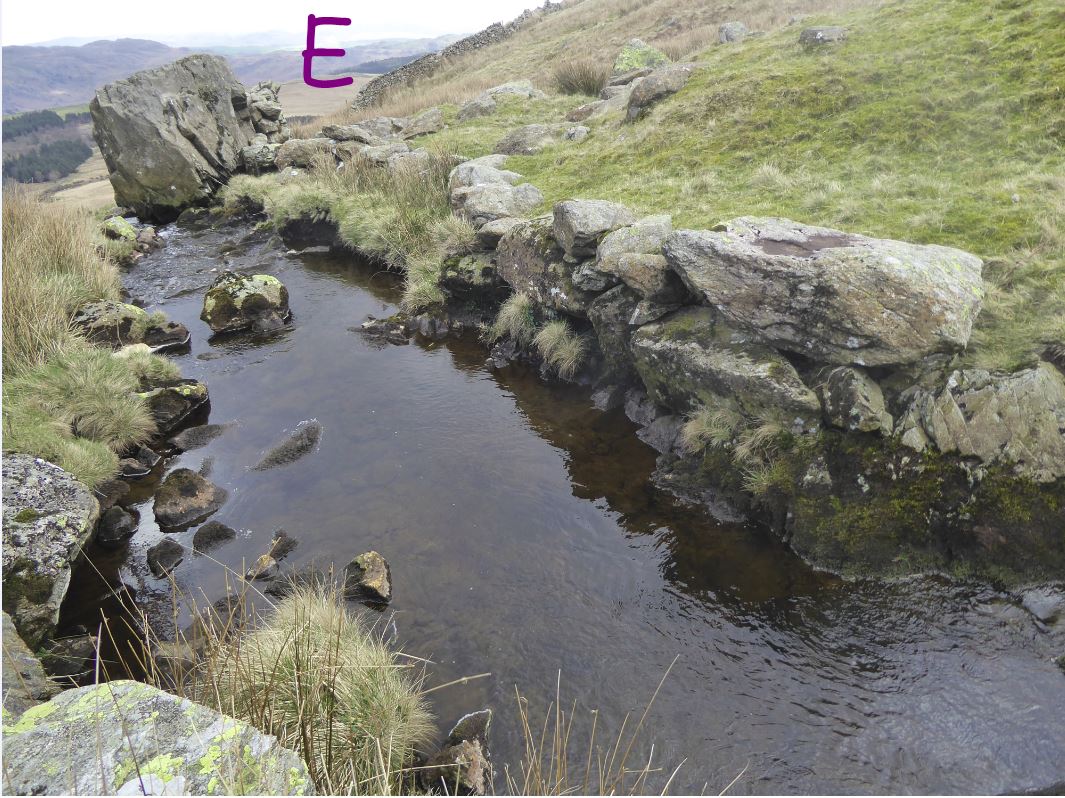
Washfold at Sele Bottom on Logan Beck. The fold is located at SD 16366 91857 at an altitude of 340m above sea level. It is recorded in the National Park Heritage Environment Record as 61097 and is not recorded in the Duddon Valley Local History Group survey, Ring Cairns to Reservoirs (R2R) survey in 2009. It is in Cumberland, previously Copeland. Its condition is medium/good and the certainty that it is a washfold is good.
Constructed from quarried and glacial stones. There are large boulders and a small outcrop the in base of the wall.
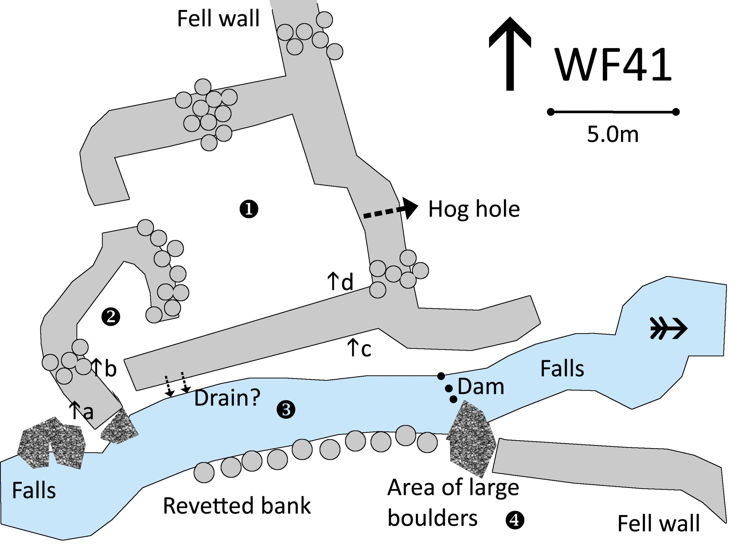
Click on plan to enlarge then use back arrow to return to this page
Dimensions: chamber 1- 7.8×7.2m; chamber 2- 3.5×4.0m; pool 3- 12.0×4.0m
Wall heights: a 1.4m; b 0.9m; c 1.7m; d 0.8m
Description:
The two chambers are built on a massive revetment above the beck abutting the fell wall. The main chamber is square with an entrance in the west wall. The second chamber is much smaller and the dividing wall is largely tumble. The exit is about 1.5m above the beck. The long pool lies between two sets of waterfalls and has a substantial revetment to the far bank before a large outcrop where there are signs of a dam. The whole enclosure is overgrown with rush covering half of the height of the hog hole. There is a large drain visible to the east of the exit that is obvious above the beck but not easy to find inside the chamber. On the far side of the beck, there are lots of large boulders and it is hard to make out whether they are part of another structure or naturally positioned on the fell side.
Recorded by: Stephe Cove and Dave Hughes on 2nd April, 2022
WF42 in Area 10, River Duddon, South of Sella
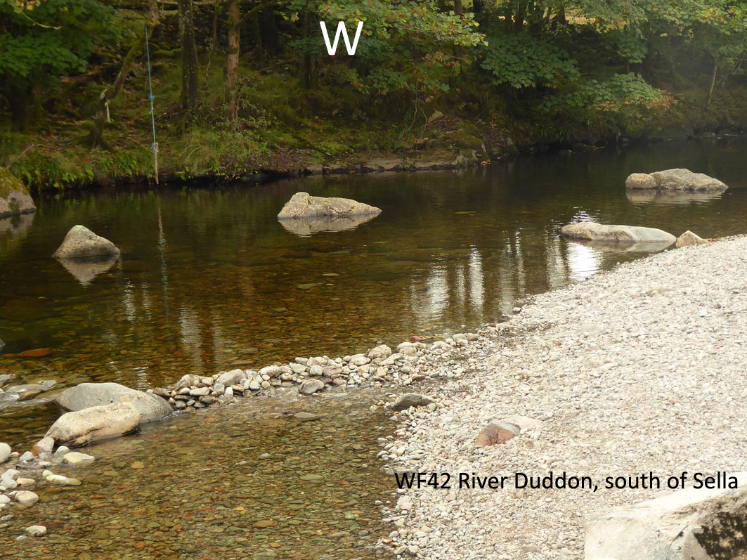
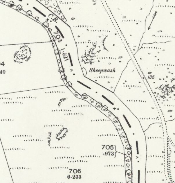
This site is a late entry and was noticed on the 25″ OS Lancashire VI.3 1890 map where it is labelled sheepwash. *(It should really be in Area 9 North but there was a space here without having to do a lot of renumbering!).
It is located at SD 1996291793 at an altitude of only 44m above sea level. It is on the River Duddon between Sella Farm and Cinderhill Beck. We have no record from the National Park Heritage Environment Record and is not recorded in the Duddon Valley Local History Group survey, Ring Cairns to Reservoirs (R2R) survey in 2009. It is in Westmorland and Furness, previously South Lakeland. There is a large, deep pool that is about 10.0m square and a flat area of shingle beach with no indication of the fold marked on the 1899 map. Any stonework is unlikely to have survived over one hundred years in an exposed site like this.
Recorded by: Stephe Cove on 17th September, 2022
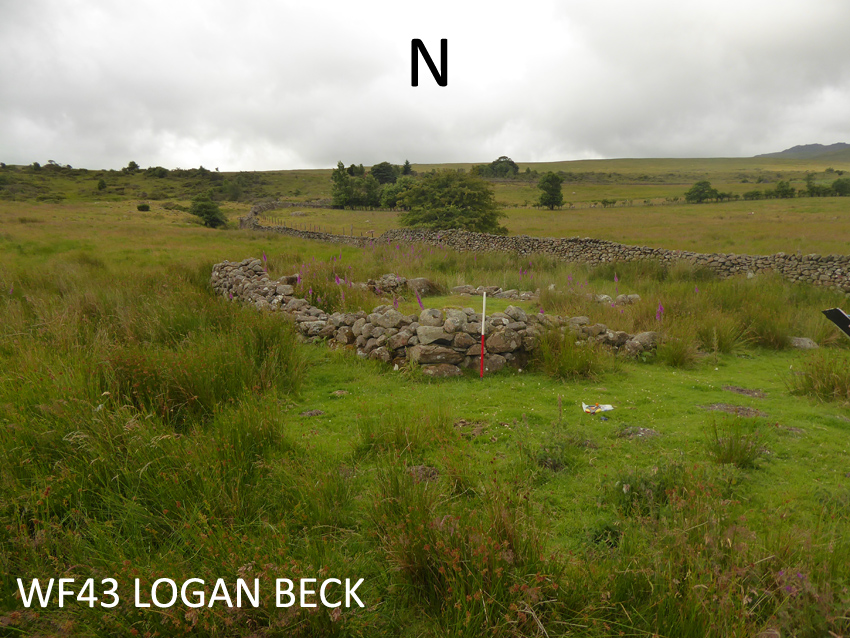
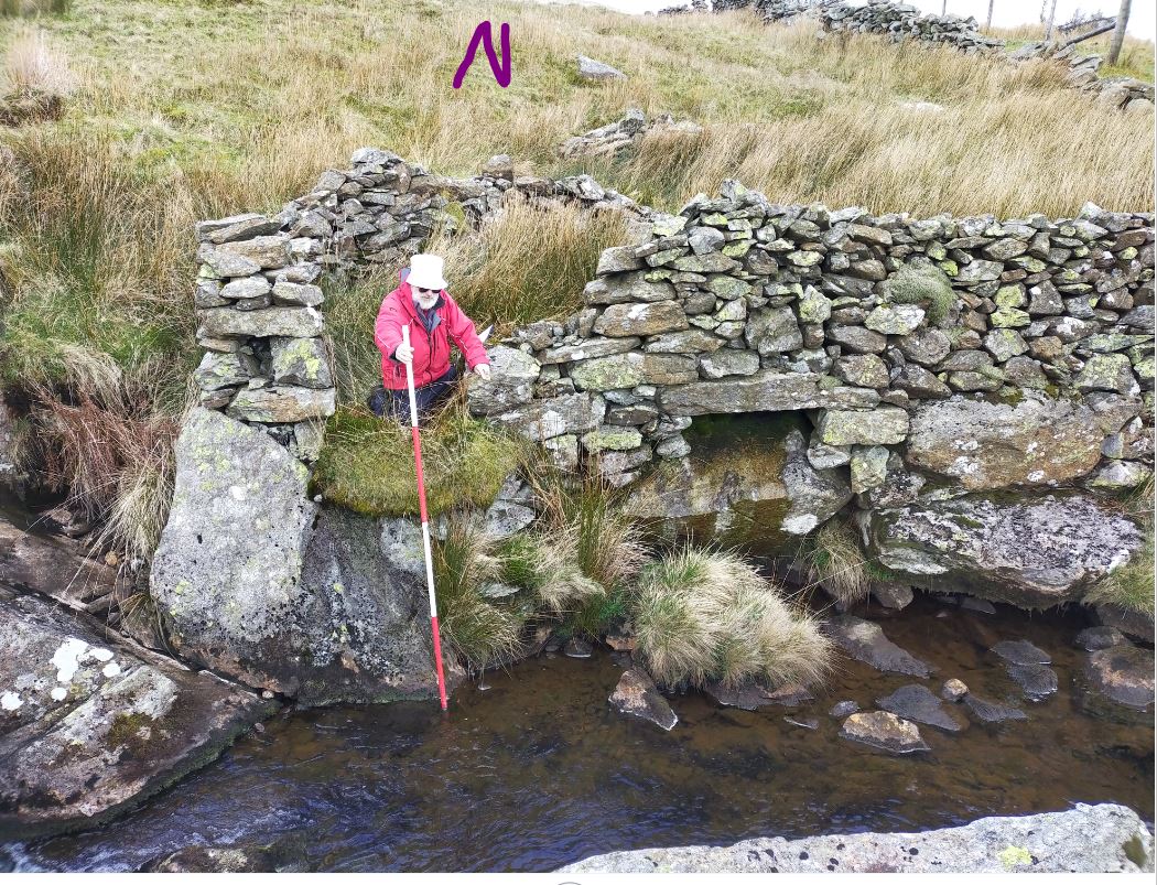
Washfold at Logan Beck Bridge on Logan Beck. The fold is located at SD 18327 90244 at an altitude of 300m above sea level. It is recorded in the National Park Heritage Environment Record as 61092 but is not recorded in the Duddon Valley Local History Group survey, Ring Cairns to Reservoirs (R2R) survey in 2009. It is in Cumberland, previously Copeland. Its condition is good and the certainty that it is a washfold is good.
Constructed from Field stones and large boulders.

Click on plan to enlarge then use back arrow to return to this page
Dimensions: Chamber 1- 8.0×7.8m; chamber 25.7×2.0m; pool 3- 5.8×1.0m; pool 4- 3.2×2.0m
Wall heights: a 0.4m; b 0.6m; c 1.2m; d 0.6m; e 0.4m; f 0.2m; g 0.7m
Description:
A largely clear, flat area very close to the road. Most of the walling has tumbled with only one corner approaching full height. Chamber 2 is fully infested with rushes. Pool 1 is a straight section of the beck close to the platform along the eastern wall. It shows no clear evidence of being dammed but would have created a pool back to the junction of the two becks. Pool 2 is a smaller but deeper section on a bend with a large outcrop on the far side. To use this pool, the entrance would have had to be used as the exit to the pool.
Recorded by: Stephe and Mur Cove on 3rd July, 2022
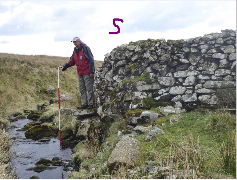
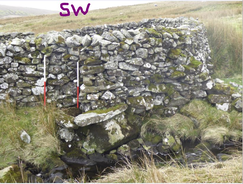
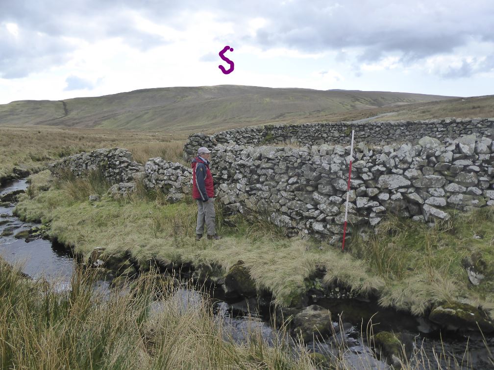
WF44 in Area 10, Thwaites Fell
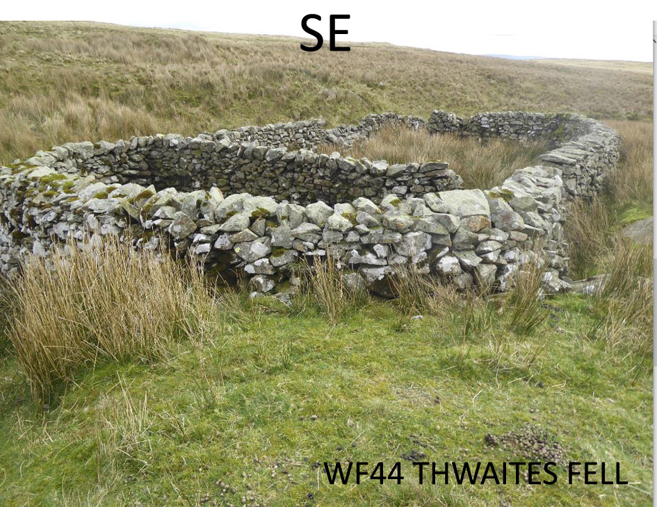
Washfold at Thwaites Fell on a feeder to Black Beck. The fold is located at SD 16216 89763 at an altitude of 315m above sea level. It is recorded in the National Park Heritage Environment Record as 61100 and is not recorded in the Duddon Valley Local History Group survey, Ring Cairns to Reservoirs (R2R) survey in 2009. It is in Cumberland, previously Copeland. Its condition is good and the certainty that it is a washfold is good.
It is constructed from fell stone.
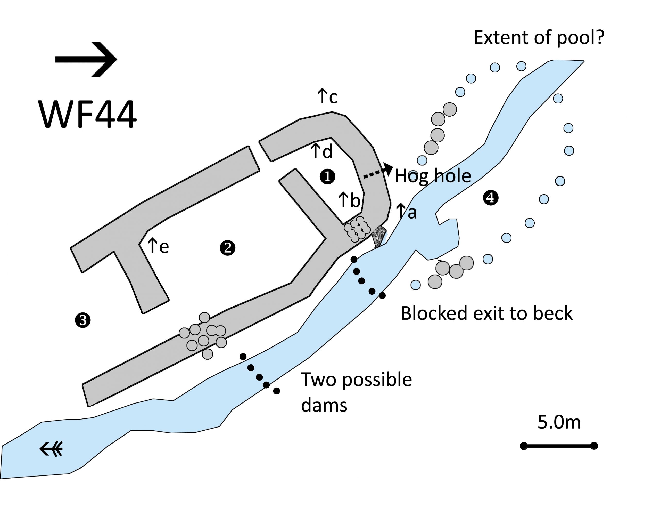
Click on plan to enlarge then use back arrow to return to this page
Dimensions: chamber 1- 6.4×3.6m; chamber 2- 11.2×8.3m; chamber3- 7.1×7.0m; pool 4- 8.0×5.0m
Wall heights: a 2.3m; b 1.5m; c o.6m; d 1.7m; e 1.6m
Description:
A well built two chambered washfold on Black Beck less than a hundred metres above the bridge on the Corney Fell Road. There are two driving walls that lead to wide (2.6m) entrance from the fell. There is a second entrance from the fell close to the dividing wall between the chambers. The exit to the beck is blocked up in chamber 1 where there is a hog hole with closing stone. The launching stone stands above a pool that has stone revetments and earth banking which, when dammed, could create a pool about 15x8m with a depth approaching a metre.
Recorded by: Stephe Cove and Dave Hughes on 2nd April, 2022
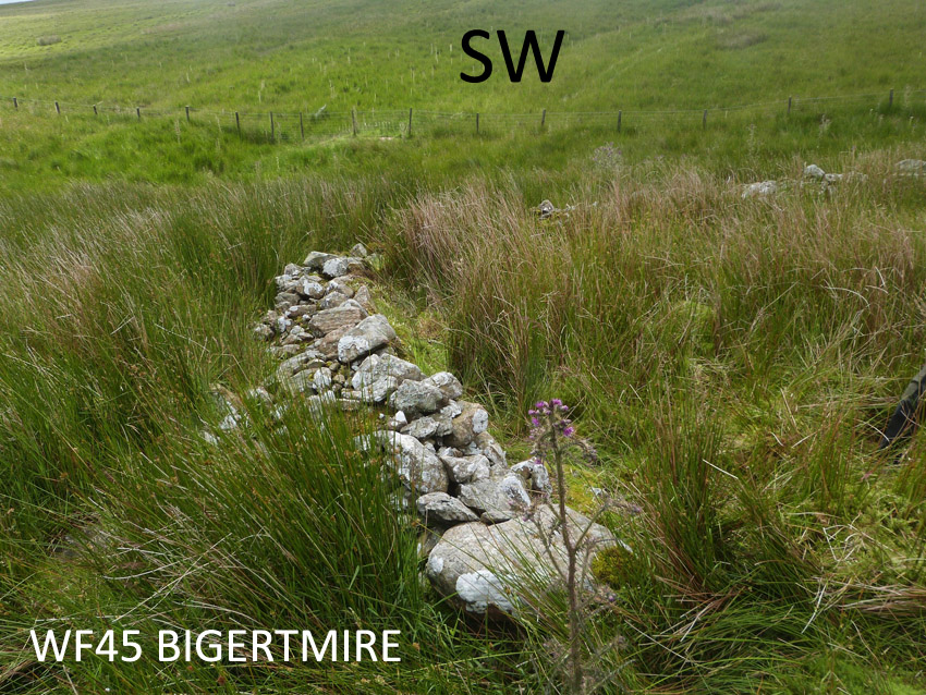
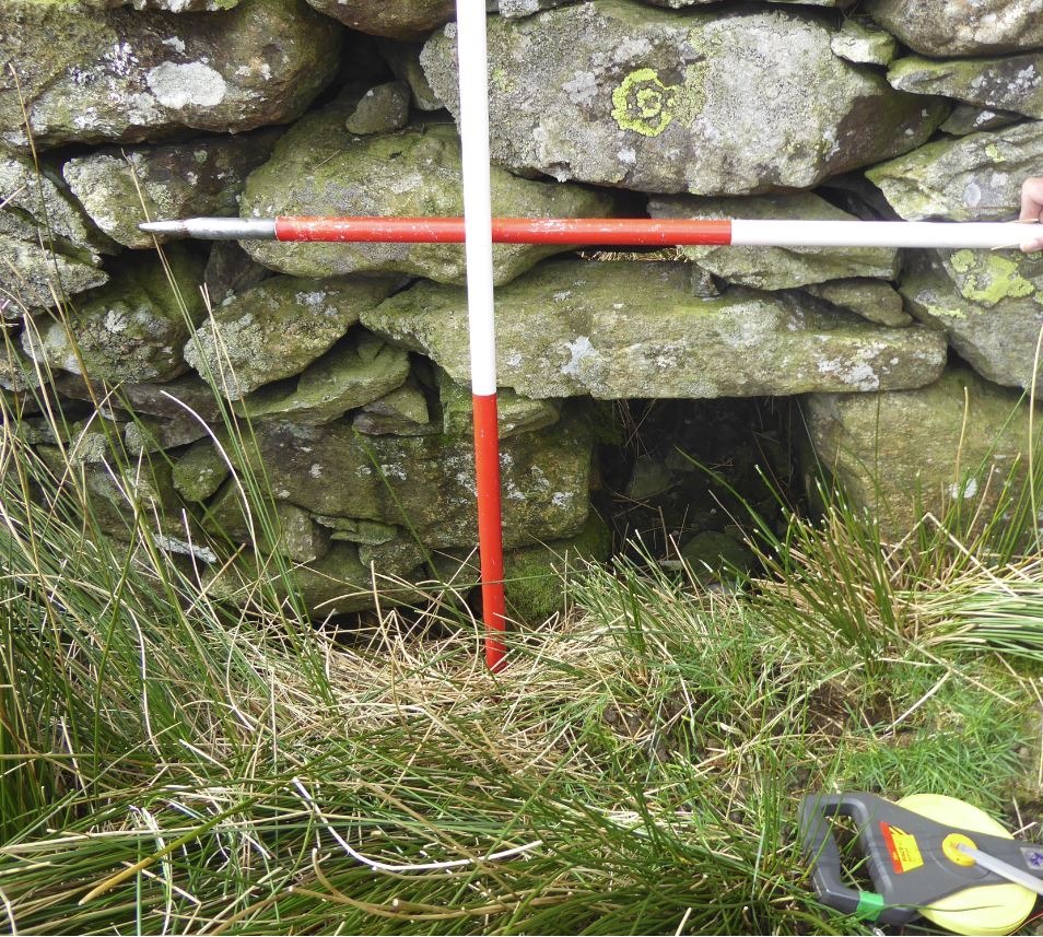
Washfold above Bigertmire on a feeder beck to Storthes Gill. The fold is located at SD 16620 93432 at an altitude of 343m above sea level. It is not recorded in the National Park Heritage Environment Record and is not recorded in the Duddon Valley Local History Group survey, Ring Cairns to Reservoirs (R2R) survey in 2009. It is in Cumberland, Copeland. Its condition is poor and the certainty that it is a washfold is medium.
Constructed from field stones.
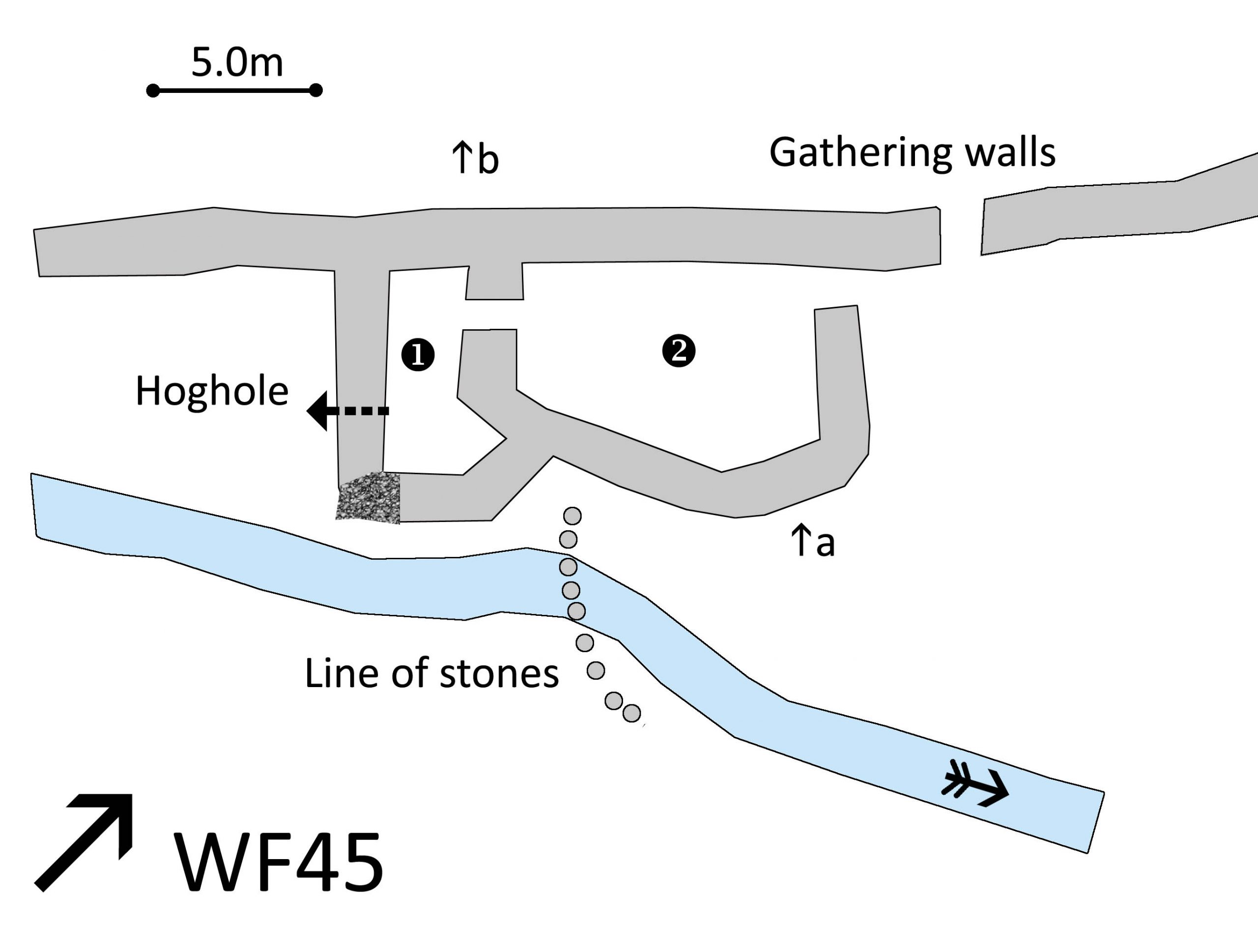
Click on plan to enlarge then use back arrow to return to this page
Dimensions: chamber 1- 5.8×2.0; chamber 2- 8.5×5.6m
Wall heights: tumbled fold walls 0.5m; field wall 1.2m
Hoghole: 0.5m wide, 0.4m deep
Description:
Two chambered fold in a remote location full of rush. Remains of a hoghole in chamber 1 where a 1m gap in the corner of the wall leads to a launching area above beck which is also buried in the rush. Evidence of an old gap between chamber 1 and chamber 2. Sheep could be driven from either direction along the fell wall. There was a gap to the fold side of the wall. The sides of the gap have square incuts for wooden hurdles.
Recorded by: Dave Hughes, Ken Lindley, Barbara Green and John Jordan on 2nd July, 2022
WASHFOLD HOME PAGE ——WASHFOLD AREA MAPS PAGE —— WASHFOLD SURVEY PAGE